Title
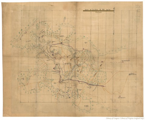
[Federal fortifications near Petersburg in the region of Fort Gregg].
Created / Published
[1864?]
Subject Headings
- Fortification.--Virginia--Petersburg Region Fortification.--Virginia--Petersburg Region
-Petersburg Region (Va.)--History--Civil War, 1861-1865
-United States--Virginia--Petersburg Region
Notes
-Anonymous pen and ink manuscript map drawn on tracing linen showing
Civil War fortifications, roads, railroads, rivers and vegetation.
-Drawn on a 1-inch grid.
-This item is in the Map Collection of the Library of Virginia;
please contact the Library's Archives Research Services department
for more information.
-Title from bibliography.
-Swem, E.G. Maps relating to Virginia, 1095
-Available also through the Library of Congress web site as raster image.
-c. 1, source unknown, c. 2, photocopy, LVA; March 2004, Map Cataloging Team.
-Civil War project no.: lva00192.
-Copy 1: Conservation: restored 1968; Etherington Conservation Center, Jan. 2004.
-Copy 1: map accession no. 5254;
copy 2 (negative photostat, LVA, aprox. 40 x 49 cm.)
-Digital image available: 15 x 18 in.
-Previously filed as: 755.62 M6 1861-1865 1864 (1).
Medium
1 map : ms., col. on linen ; 38 x 46 cm.
Repository
Library of Virginia Richmond, VA 23219-8000 USA
vau For copies contact: Archives Research Services.
Digital Id
glva01 lva00192
http://hdl.loc.gov/loc.ndlpcoop/glva01.lva00192
|
|
 chapter 18